1/15




Natural Disaster Monitor
1K+Downloads
8.5MBSize
5.12.3(14-12-2024)Latest version
DetailsReviewsVersionsInfo
1/15

Description of Natural Disaster Monitor
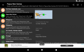
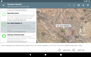
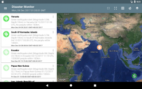
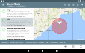
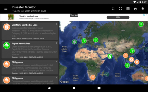
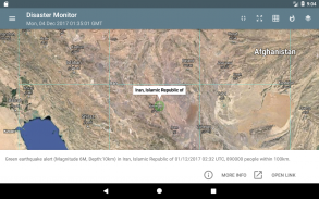
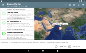
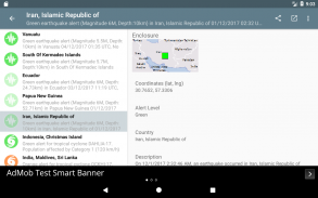
আপনি বিশ্বজুড়ে প্রাকৃতিক দুর্যোগগুলি পর্যবেক্ষণ করতে পারেন, যেমন গ্লোবাল বিপর্যয় সতর্কতা ও সমন্বয় ব্যবস্থা - www.gdacs.org দ্বারা প্রকাশিত। অ্যাপটিতে সর্বশেষতম প্রাকৃতিক বিপর্যয়ের মতো ভূমিকম্প, খরা, আগ্নেয়গিরির অগ্ন্যুৎপাত, গ্রীষ্মমণ্ডলীয় ঘূর্ণিঝড়, সুনামি এবং বন্যাকে একটি তালিকাতে রঙিন কোডেড আইকন হিসাবে এবং গুগল ম্যাপের ব্যাকড্রপগুলিতে দেখানো হয়েছে; আইকন রঙগুলি সতর্কতা স্তর নির্দেশ করে - সবুজ, কমলা এবং লাল। ইভেন্টটি পুরানো হওয়ার পরে আইকনটি আরও স্বচ্ছ দেখাবে। আইটেমটি ক্লিক করা বিপর্যয়ের ঘটনা সম্পর্কে আরও বিশদ আনবে। ইউটিএম বা ভৌগলিক গ্রিডগুলি মানচিত্রে allyচ্ছিকভাবে প্রদর্শিত হতে পারে।
* এখন ডার্ক মোড সেটিং সহ।
Natural Disaster Monitor - Version 5.12.3
(14-12-2024)What's newAdd null checks for bitmap conversion
Natural Disaster Monitor - APK Information
APK Version: 5.12.3Package: com.dom925.disastermonName: Natural Disaster MonitorSize: 8.5 MBDownloads: 5Version : 5.12.3Release Date: 2024-12-14 15:52:22Min Screen: SMALLSupported CPU:
Package ID: com.dom925.disastermonSHA1 Signature: E5:9D:19:FD:8D:A4:3A:AF:CD:14:FF:7A:C8:C2:21:93:15:E5:49:67Developer (CN): Dominic ChinOrganization (O): Local (L): Country (C): SGState/City (ST): Package ID: com.dom925.disastermonSHA1 Signature: E5:9D:19:FD:8D:A4:3A:AF:CD:14:FF:7A:C8:C2:21:93:15:E5:49:67Developer (CN): Dominic ChinOrganization (O): Local (L): Country (C): SGState/City (ST):
Latest Version of Natural Disaster Monitor
5.12.3
14/12/20245 downloads8 MB Size
Other versions
5.12.2
11/12/20245 downloads8 MB Size
5.11.120
10/6/20245 downloads8 MB Size
5.6.115
14/8/20205 downloads3 MB Size
4.0.1
19/11/20155 downloads3.5 MB Size


